- SmartGis México
Thematic Maps
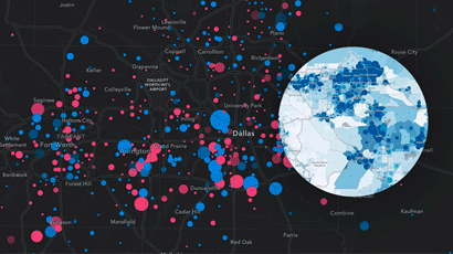
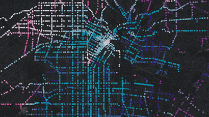
The thematic maps show the different variables of a particular geographic area indicating the location and distribution of the phenomena analyzed, so your data will be displayed dynamically and with updated information at the time.
These maps are created in different layers that are superimposed on a general map that functions as a reference to show where the analyzed phenomena converge, highlight patterns and relationships between them. Obtain different angles to reach different conclusions.
They contain pop-up windows to display useful information, include attributes, abstract concepts and reference other types of data.
- Point distribution map
- Vegetation Map
- Heat map
- Geological Map
- Land Occupancy Map
- Inventory maps
Tell the story of your data through thematic maps
With our thematic maps, your management and analysis task is made easier as they are a useful tool for transmitting a large amount of diverse information.
Its design allows maps to be automatically updated when linked data changes.
They capture the interest of users and are quite simple and easy to understand for all types of audiences.
Phone
+52 5573847404info@smartgis.mx
Hour
9:00 am a 18:00 pm
Social Networks
Services
Business
Courses
- Arcgis Pro
- ArcMap
- Arcgis Online
SmartGis México
We develop knowledge at strategic planning levels through the use of GIS.
SmartGIS Copyright © 2022 . All Rights Reserved.