- SmartGis México
Cartographic Creation
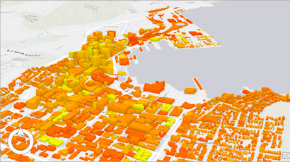
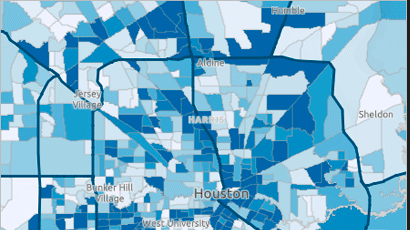
We can say that digital cartography is a way of representing maps through computer technology, which is achieved through the use of Geographic Information Systems or GIS, which encode and manage geolocated data found in geospatial databases.
Digital cartography also involves statistical applications, design programs and remote sensing using sensors located in space satellites, which consists of nothing more than generating digital maps without the manual intervention of a person, but through the intervention of technologies that update the information contained in these maps by dumping the new data present in the GIS.
- Cadastre
- Urbanism
- Photogrammetric restitution
- Raster cartography
- Vectorial Cartography
- Digital Models
Benefits
Measurement data obtained by direct and indirect methods are filtered and edited, and topological cleaning processes are applied to them so that they can be incorporated into any geographic information system.
Preparation of maps in digital format for projects adapted according to the needs of the study to be carried out. This includes the generation of information, preparation of base cartography and preparation of studies for its implementation.


Phone
+52 5573847404info@smartgis.mx
Hour
9:00 am a 18:00 pm
Social Networks
Services
Business
Courses
- Arcgis Pro
- ArcMap
- Arcgis Online
SmartGis México
We develop knowledge at strategic planning levels through the use of GIS.
SmartGIS Copyright © 2022 . All Rights Reserved.