- SmartGis México
Strategic Vision to improve services
Acquire the tools to change management models, clearly visualize what is happening in the territory and optimize analytical processes for decision making, follow up on the progress of your objectives, plans and programs through indicators, act in the area where you will have the greatest community benefit, promote governance with better communication with citizens.
- Key Asset Management
- Planning System
- Ordinance and Urban Regulation
- Governance
- Global Consciousness
- Citizen Security
- Disaster Prevention and Response
- Education
- Communication
The benefits you get
The current management models of local governments are not sufficient to face and respond to the growing management demands required in their territory and to provide an effective response to their citizens.
Be one of the governments that are increasing the institutional maturity of public administration to meet the new challenges, revolutionizing its administrative and service management model, communication, citizen participation and transparency through geographic information systems.
MODULES
Our solutions are integrated by different modules, which can be customized and adapted to the user’s needs and operating rules, and are available individually or in packages.
- Certain points and scopes are conditioned to the existence of Territorial Management Studies, Plans and Programs, information provided, official information and open data from governmental platforms.
- The Services included in the modules only process data that are available on official sites and those provided by its clients, SmartGIS does not generate or produce any type of data or information unless the client requires a specific study.
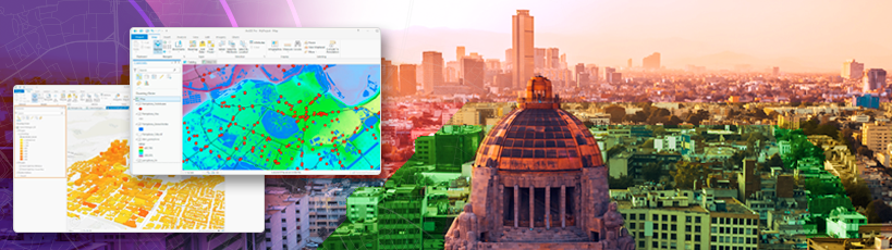
Innovative managers use maps and intelligent dashboards to achieve a holistic view of their assets. Location intelligence improves daily operations such as inspections, maintenance and planning of works and services
- Citizen Report
- Inventory of assets with information of general interest
- Real-time location tracking
- Tell stories with maps
Make Urban and Regional Impact projects congruent with higher level instruments and obtain favorable opinions from State and Federal authorities in urban and environmental matters.
- National Development Program
- National Land Management Strategy
- National Program for Land Management and Urban Development
- State Land Management Program
- Regional Land Management Program
- River Basin Ecological Management Program
- Metropolitan Area Land Use and Zoning Program
- Municipal Land Management Program
- Municipal Urban Development Program
- Thematic Maps for consultation of current official programs.
- Data from official sources.
Cadastre
- Modernization of the Cadastral System
- Digitization of Archives
- Document Management System
Urban Development
- Licenses and Permits
- Inspections
- DRO Logbook (Public and Private)
- Official numbers
- Alignments and Boundaries
Pantheons
- Cadaster of Cemeteries
Trade
- Operating licenses
- Inspections
- Verifications and Updates
Collaborate to improve urban equity and quality of life for citizens. Dialogue with citizens with impactful interaction. Prioritize open or targeted community participation, integrate them in planning and decision making to decrease spatial segregation, unify and legitimize public policies will increase transparency and trust in government.
- Report and Communicate in a visual and interactive way
- Opinion Surveys – Budgetary Deliberation
- Public Works – Private Investment
Promote Sustainability, learn about the stress between the areas that have the greatest impact on human development at the local level and your responsibility at the global level.
Cities, the place where people reach their greatest development and, paradoxically, where the greatest challenges are generated… Where are we, where are we going?
- International Agreements
- Legal Framework
- Agenda 2030-ODS, NAU, PCES, CPI
- GHG Inventory
- Government Commitments for Mitigation and Adaptation
- CES, CPI, ODS indicators.
- Executive summary of analysis
- Coastal erosion
- Urban sprawl
- Environmental degradation (USV vs. Strategic Areas ZP)
- Urban Segregation Thematic Maps
Communities across the country face increasingly complex threats and hazards that put residents at risk. Use location intelligence to see high-risk areas, analyze causes, establish patterns of action and optimize response plans and actions. Track incidents, prevent crime. Share real-time information with law enforcement and implement actions to combat crime. Activate citizen security networks in real time.
- Crime map
- Inventory of assets with information of general interest
- Real-time location tracking
Human settlements are increasingly threatened by climate change and the risks generated by anthropogenic activities. Smart maps identify areas of potential risk, reveal more in-depth information on how to manage risk, and provide a shared vision that streamlines communication during all phases of the event.
Those responsible for the protection of inhabitants need to anticipate possible damages in the face of any predicted climatic event or anthropogenic incident likely to occur. Use geolocation for preventive actions and to establish security protocols, visualize the environment of the most vulnerable areas before an incident occurs.
- Risk Atlas (CENAPRED)
- Climatological Bulletins
- Event registration
- Shelter and Soup Kitchen Sites
- Leaks and Spills
- Grassland burning
- High impact accidents
- Effective coordination of resources
- Delimitation of affected areas
- Damage count
- Crime map
- Inventory of assets with information of general interest
- Real-time location tracking
- View service and incident reports
Achieve consensus and legitimacy of public policies and actions undertaken by the government. Disseminate scientific information on global challenges, national objectives and goals to contribute to solutions, as well as local government actions in the short, medium and long term, help educate and engage citizens. Convey the government’s vision, inform solution-focused work at the local level, with repercussions at the global level and contribute to creating a collective awareness of sustainability.
- Develop Institutional Maturity
- Achieve situational awareness in the population
- Raise awareness of major global challenges and government actions to overcome them
- Encourage participation
- Tell stories with maps
- International Agreements
- Legal Framework
- Agenda 2030-ODS, NAU, PCES, CPI
- GHG Inventory
- Government Mitigation and Adaptation Commitments
- CES, CPI, ODS indicators.
- Executive summary of analysis
- Coastal erosion
- Urban sprawl
- Environmental degradation (USV vs. Strategic Areas ZP)
- Urban Segregation Thematic Maps
Achieve consensus and legitimacy of public policies and actions undertaken by the government.
Show your Development Plan by means of intelligent maps. Make known the objectives and actions of the government in the short, medium and long term, what problems it solves, where they are located and what is their area of influence, who and how many are the beneficiaries.
Conduct online and geo-referenced opinion surveys, general or disaggregated, open or targeted to a group of interest, learn and get feedback on citizen perception, evaluate whether government policies have been adequately transmitted.
- Disseminate the Development Plan, communicate its progress.
- Get to know public opinion.
- Encourage citizen participation
- Tell stories with maps
- Promote government campaigns
- Report on citizen events
- Interact with society
- Government Reports
- Job Opportunities
- Show Socioeconomic Data
- Report and Communicate in a visual and interactive way
- Opinion Polls – Budgetary Deliberation
- Development Plan
Phone
+52 5573847404info@smartgis.mx
Hour
9:00 am a 18:00 pm
Social Networks
Services
Business
Courses
- Arcgis Pro
- ArcMap
- Arcgis Online
SmartGis México
We develop knowledge at strategic planning levels through the use of GIS.
SmartGIS Copyright © 2022 . All Rights Reserved.